 These two trips were a foray into the stark granitic wilderness of northern Kings Canyon National Park.
I had not explored the area beyond Bishop Pass before, and the area was new to Vladimir as well. On the first trip
on the weekend of July 19th, 2003, we attempted to climb Mount Agassiz on a day hike; on the second trip on the
weekend of August 9th we targeted Mount Sill which we never reached, but along the way Vladimir climbed a chute
on North Palisade's west side, and both of us climbed Mount Agassiz after coming back to Bishop Pass.
These two trips were a foray into the stark granitic wilderness of northern Kings Canyon National Park.
I had not explored the area beyond Bishop Pass before, and the area was new to Vladimir as well. On the first trip
on the weekend of July 19th, 2003, we attempted to climb Mount Agassiz on a day hike; on the second trip on the
weekend of August 9th we targeted Mount Sill which we never reached, but along the way Vladimir climbed a chute
on North Palisade's west side, and both of us climbed Mount Agassiz after coming back to Bishop Pass.
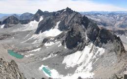
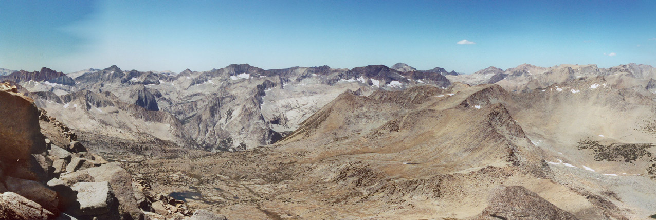
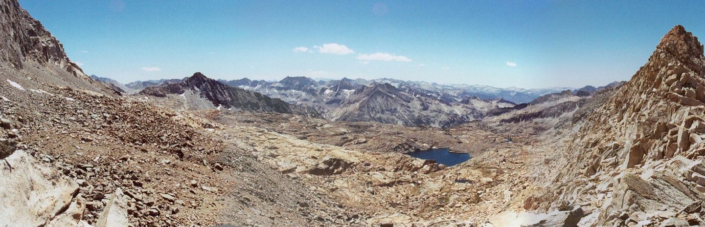
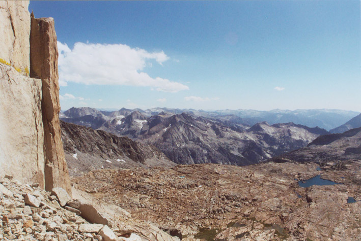
All three mountains are in the Palisade Group of Sierra Nevada. North Palisade (14,242'/4341m) is the highest of
the group and the 4th highest mountain in California; Mount Sill (14,162'/4317m) is the second highest of the group
and 6th highest in California; Mount Agassiz (13,893'/4235m) is the 20th highest mountain in California. Since Mount
Agassiz is directly above Bishop Pass, it is possible to day hike it. The approach is the 6 miles of Bishop Pass
trail with about 2000+ feet elevation gain. The west slope route starts at Bishop Pass and goes straight up for another
2000 feet; it is rated class 2 by most sources.
North Palisade and Mount Sill are not quite so easy. North Palisade is considered the hardest mountain over 14,000
feet high in California, whose easiest route is rated class 4 and involves serious alpine climbing.
I will probably never make an attempt to climb this mountain without technical equipment. Mount Sill on the other hand
has a class 2-3 route on its southwest side. This route requires approach from Bishop Pass trail, then traversing
cross-country across Dusy Basin and Palisade Basin. The total mileage is almost 11 miles to the base of the mountain.
I planned our August 9-11th trip targeting Mount Sill using this approach, but ultimately it proved to be not enough
time and preparation for this giant mountain.
July 19th, 2003
Vladimir and myself drove to the eastern Sierra on the night of July 18th, and slept in the Pine Creek Canyon,
our usual camp spot not far from Bishop area, elevation 7200'. We arrived way past 3 am and had a short 4 hours of
sleep. We left camp
and started driving to South Lake trailhead at around 8 am. After sorting out our day packs, we started hiking on
Bishop Pass trail at around 9:30. The weather was gloomy and overcast, but it was a good thing for us since we won't
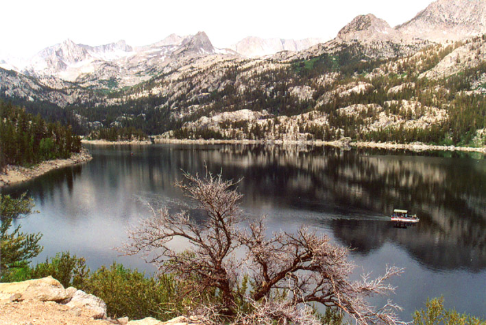
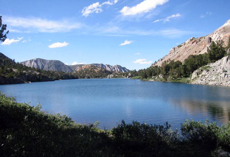
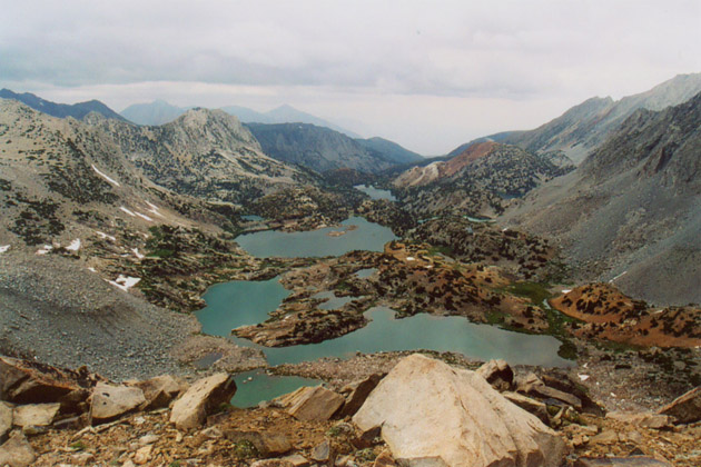
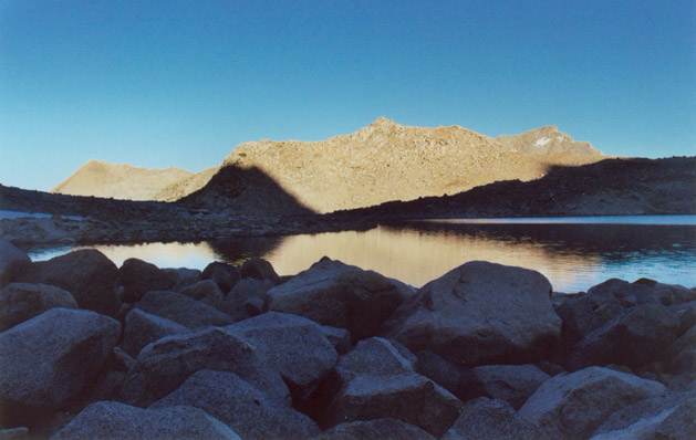
be sweltering on this long, steep trail. The scenery was stunning as we hiked up to a series of large blue lakes set
amongst soaring white granite peaks; Long Lake and Saddlerock Lake were the prettiest, and the steep fluted north face
of Mount Goode (13,085'/3988m) was picturesque. All around us there were lush meadows and multitudes of brilliant
wild flowers, most notably the orange leopard lily, red and white columbines, red paintbrush, and pink shooting stars.
Around 12:30, as we reached the Bishop Lake area, the sky become even more dark and cloudy. It started drizzling,
and we decided to rest on some rocks with our rain caps on. The rain stopped after maybe 20 minutes. We proceed steeply
up the many switchbacks right below Bishop Pass. Mount Agassiz is looming large on the left, but its top are often
shrouded in clouds. Not a good sign. We continue up the rocky trail to Bishop Pass. It started to rain more heavily,
with thick mist in the air. At about 2 pm we reached the plaque marking the pass and entrance to Kings Canyon National Park. We met
2 groups of hikers descending from the back country, and no one predicted the weather would clear up any time soon.
We decided to sit down with the rain cap on our heads. It took maybe 40 minutes and the rain stopped. We discussed our
options, and I proposed climbing up Mount Goode on the west side of the pass. It will not be that easy however, since
it will take traversing three sub-peaks to reach Mount Goode, and I was hoping that we could descend directly down to
Bishop Lake from there. We make it up the buttress west of Bishop Pass for about 20 minutes and 300 vertical feet, then
Vlad had a different idea. He saw that the top of Mount Agassiz is emerging from the clouds, so he convinced me to
follow our original plan to climb Agassiz instead. It is a better plan as the descent from Agassiz will be simpler and
Agassiz is a much more significant peak also. However, I was feeling drained of energy from the cold rains, and I told
Vlad I would probably only make it half-way.
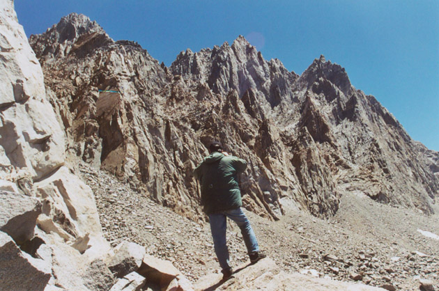
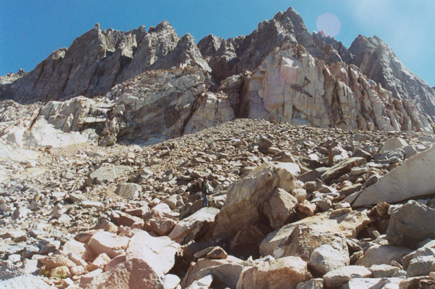
We started up a fairly steep chute on the west slope of Agassiz, which was made up of large, firm talus. The climbing
was not difficult, but not as what I imagined class 2 to be. It seemed more like class 3 in most places. Although I
heard all chutes on west side of Agassiz are the same, now I believed that this was not the easiest chute. There was
a small snowfield a little less than half-way up the chute, and we reached there about 6 pm. I decided to wait for
him since he insisted on going to the top, and I thought it wouldn't take that long. We also made a decision to descend
in the next chute to the right (south)
since it seemed less steep, so I went a few steps to that chute to wait. Soon I was out of sight of Vlad, and I became
nervous since I did not have a watch with me. I called out from time to time and got no response. Then clouds quickly
shrouded the top of the summit again, and mist started traveling down the slope towards me. It started raining, and I
felt very cold since I was not moving. I shivered in the rain, then found a little rock overhang to hide under, although
it didn't help much. I was increasingly worried that Vlad would come down the wrong chute in the poor visibility.
After 7:30 pm the sun started to set, and I became so cold I had to move. I started to descend on my own, knowing I would
be warmer moving and safer waiting for him below, especially if he came down the wrong chute. Not long after I heard
Vlad calling out for me. Apparently he was having difficulty descending the upper part of the right-side chute, since
the terrain was a big headwall. Finally the rain stopped again, and with some directions from me Vlad descended to
meet me, but it took a while.
I was pretty upset at Vlad for attempting this peak in such bad weather, but it was also my fault as well. We hurried
down the rest 40% of the slope, which was indeed easier in the right-hand chute. Vlad was complaining about lack of
energy to descend, but I felt better now once we're on our way down. We didn't have a good breakfast and it's now
hurting his energy level. We hiked through the arduous Bishop Pass trail in the dark with headlamps. My headlamp lost
contact soon and we shared the light on one lamp for the remainder of the way. Numerous rest breaks were taken as I
was feeling an upset stomach while he was totally exhausted. Finally we reached the car around 11 pm. I found out Vlad
didn't make it to the summit in very poor visibility, as he was not sure which one of the two humps he saw was the true
summit. He said it was a hard decision for him to give up on this one, because he was concerned about me waiting
down below in this bad weather.
We got some refreshments from the Vons grocery store in Bishop, then drove back over the night. Near Tuolumne Meadows
in Yosemite National Park (around 2:45 am), we saw someone with blood on him in the darkness standing in the middle of the road waving
at us. Apparently he crashed his car and scraped his arms. His car was flipped on its side on the roadway. We got out
and helped him call for help, and stayed around for an hour until the ranger arrived. I used my cell phone to call AAA
and the calls would drop because of low battery. Fortunately help came fairly soon, and we drove back down the Sierra
with the rise of the sun.
August 9-11th, 2003
This time we planned a backpacking trip for three days to climb Mount Sill; for this I took a vacation day off work
for Monday August 11th. The weather was predicted to be sunny and warm. We drove to eastern Sierra on Friday night
as usual, but this time we camped near the Mammoth Lakes ranger station, as we planned to wait in line before the 8 am
opening time of the ranger station in order to obtain a back country camping permit. The elevation of the camp site
was about 7700', so it would be good for acclimatization to the altitude as well. I know Bishop Pass trail area
is a very popular backpacking destination, so the limited number of permits would be gone quickly. Barely 4 hours of
sleep later, I was waken up by my alarm watch and we packed up and drove to the ranger station a few miles away. We got
our permits no problem, then we went into town to get a hearty breakfast at the Good Life Cafe. It took over an hour,
but was quite nice.
We arrived at South Lake trailhead a little after 10 am, but the overnight parking area was full except for one open
space. The car in front of us was heading to that spot, but we could have gotten it before them because they took a
roundabout way. I decided it was not worth fighting with people for the parking. We drove back down the road for 1.3
miles to the overflow parking. This was unexpectedly far and it would have added 600 feet of extra elevation gain. Good
thing Vlad was able to hail down a car to give us a lift. We got our packs ready and started hiking at 11:30.
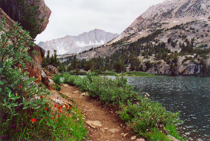
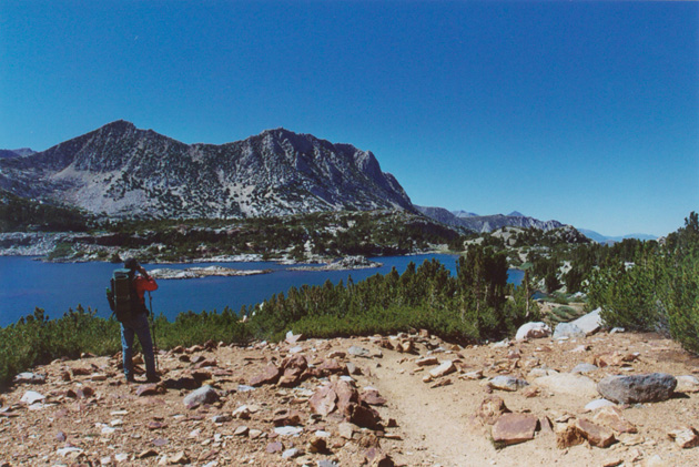
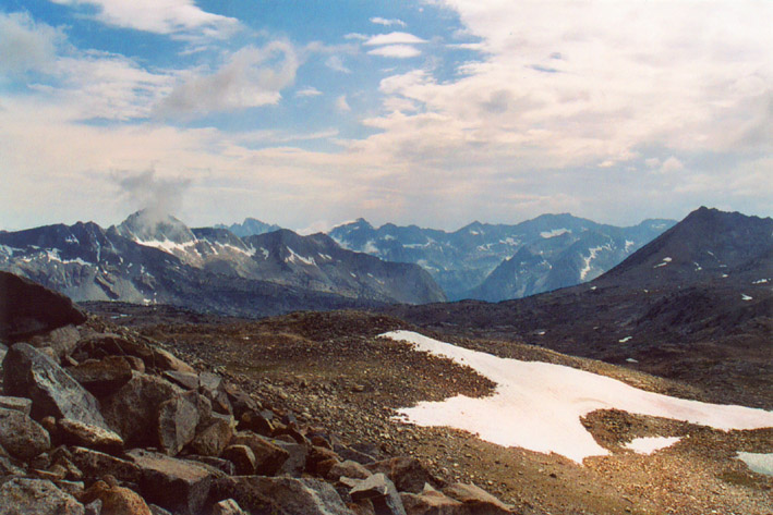
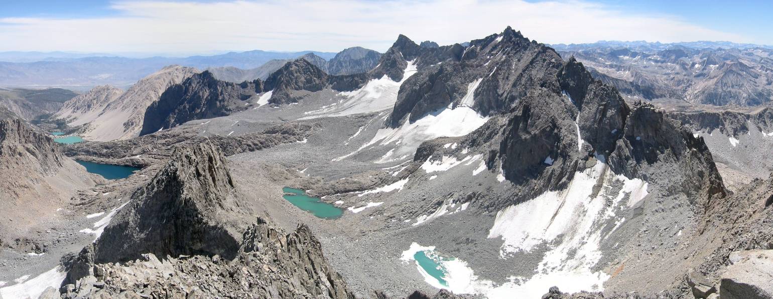
The sky was totally cloudless, and the lakes reflected amazing light. With heavy backpacks we reached Bishop Pass
around 4:30 pm, then pressed on forward into Dusy Basin cross-country to Lake 11900'. This is a very beautiful and
stark area, right
below the west slope of Agassiz. However, fierce winds was blowing acrossing the entire area due to the Bishop Pass
land gap. We hurried past the lake and soon was on the western flanks of Mount Winchell, after traversing numerous
talus fans, being careful not to lose elevation. Our goal of the day was Thunderbolt Col, a high pass (12,600')
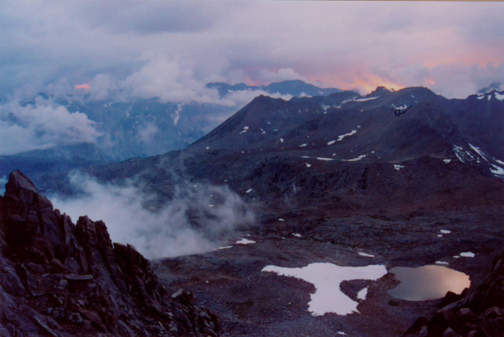
leading from Dusy Basin to Palisade Basin. The pass was not to be reached this day. The sun soon sets and we were quite
a ways from the pass. We decided to find a camp site, hopefully near water sources, but without going downhill. We
hiked over to the west flank of Thunderbolt Peak where there is a series of wet granite slabs. We found a very small
but fairly level space hidden behind huge sloping slabs. It would be good for wind protection. We called it a day
and set up camp there. Both of us were exhausted, and Vlad soon fell asleep. He complained about lack of acclimatization
the previous night, since we had so little sleep. I was exhausted as well but felt bad because there was no hot dinner
served as we had planned. The air was cold and I was hungry, so I munched on a bunch of different things. I felt better
and fell aleep soon.
The next morning we had a late start. Vlad was not getting enough sleep due to the seriously unlevel site. My half
of the camp site was much flatter so I slept fine. We cooked and ate hot food inside the tent, then left camp around
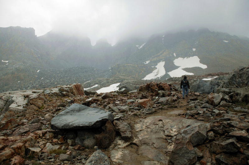
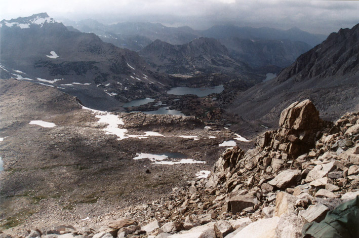
10:30 am. The route to Thunderbolt Col was difficult traversing of yet more talus, some loose scree, and quite a bit
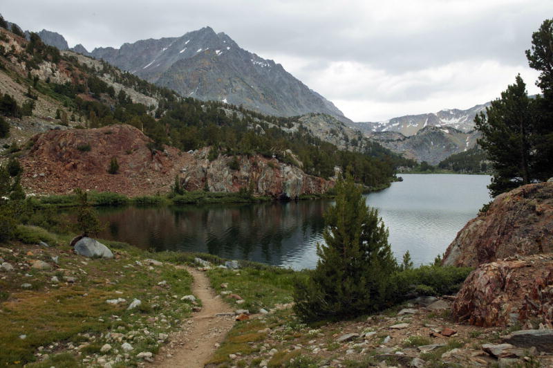
of uphill, and we reached it only after 2 hours. The view from the pass was fantastic! I couldn't count how many new
peaks (probably hundreds) were before my eyes to the south, and almost all were apparently below us. On the left side
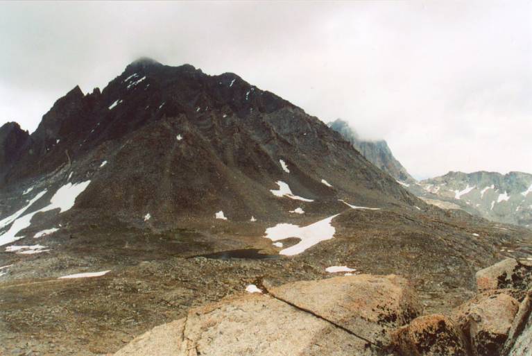
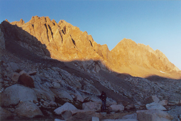
we saw the jagged vertical spires of Thunderbolt Peak and North Palisade, extremely stark and imposing.
After traversing about 4-5 talus fans, I was running out of energy and there seemed to be
still a long way to go. According to my map we're not even half-way into Palisade Basin.
It was after 2 pm, and I felt there was no way we could make it to the top of Mount Sill, and
if we pushed on further, it would only add to our misery of coming back, possibly in the dark
traversing difficult loose talus. Vlad grudgingly agreed, and proposed to explore a steep chute
just above us to the left. This turned out to be Putterman Couloir on North Palisade's west side.
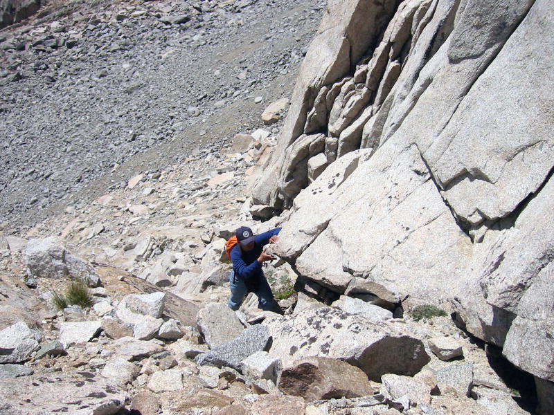
The coulouir is bound on either side by huge monolithic vertical walls, and there was much
loose scree in the middle. We climbed up along the left wall using handholds in the solid rock
there. After a hundred feet or so the middle of the chute was blocked by steep slabs which
I couldn't safely overcome, so I stayed below letting Vlad to go ahead. I thought this
was possibly the chute leading to the famous U-notch, so maybe Vlad would have a chance of
seeing Palisade Glacier and Mount Sill if he was able to climb to the east side of the notch.
During the hour Vlad was up climbing the chute, occasionally we could communicate by shouting.
Eventually Vlad headed back down, and as he did there were rocks flying down the nearly vertical
couloir at incredibly high speeds towards me. I quickly moved to hide from the blast of many
sizable flying rocks, some hitting the numerous slabs in the couloir and splitting up into
many pieces, some changing direction after hitting each slab. It was frightening as I watched
carefully the trajectory of each rock while hiding near the left edge of the couloir. I was
eventually hit three times, albeit by mostly small pieces, and none got my head. Then I understood
why the slabs in the middle of the couloir were so smooth and polished. It was definitely the
kind of serious climbing condition that I don't want to experience. Vlad came down and told
me that he encountered very smooth and steep slabs that were unapproachable, but he did snapped
a few shots while up there on one of the towers. After analyzing his digital photos I concluded
that he didn't make it to the east side of North Palisade. I only found out after coming back
home that this Putterman couloir doesn't lead to U-notch; the route from there to the summit of
North Palisade is rated class 5.5 according to Porcella & Burns's climbing guidebook to California
Fourteeners.
We headed back toward Thunderbolt Col and crossed back into Dusy basin. We were very short on
water and I was keenly aware that there weren't any apparent water sources near our camp site. Due
to the poor quality of the camp site itself, it makes no sense to stay there another night, so
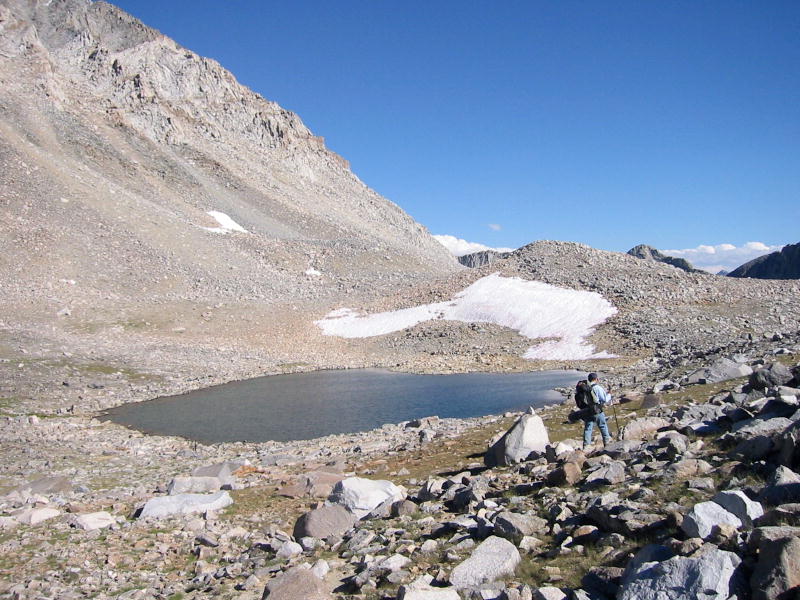
we targeted the lake near the base of Mount Agassiz, Lake 11900', as our prospective camp site.
Since we would like to climb Mount Agassiz as a consolation prize for this trip, that lake makes
a perfect staging point, and allows speedy return to trailhead. We reached the previous night's
camp site around 6:40 pm, and I immediately set out to find water. There was a series of wet slabs,
although no visible streams could be found. Eventually I found a few rock slabs dripping water,
so I started collecting it using my empty water bottle. Vlad helped by using a piece of grass
leaf to conduct the water from the edge of rock directly into the bottle. After packing up the camp
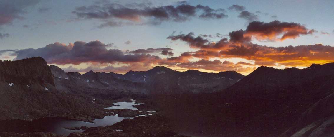
gear, the bottle was finally filled up, and I felt good drinking huge gulps. We headed back to
Bishop Pass in the twilight, and reached Lake 11900' at about 8:30. A level
camp site was easy to find a few steps from the lake, and water was easily obtained as well. This
is how back country camping should be like!
The third day morning we started climbing Mount Agassiz around 9 am. The weather was great, and
I expected to finish it before noon time. Since it will take 3 hours to get down Bishop Pass trail
and 6 hours drive to home, I wanted to finish the day as early as possible. We chose a new chute
to the left of the one we took during the last trip. The chute was quite steep and slow going,
apparently this was still not the easiest chute. Periodically cold winds would blow across and
made me very uncomfortable. My only warm jacket was a fleece one without a hood for the head.
Around noon we were near the top of the chute, about 2/3 of the way up. I decided to let Vlad finish
the climb on his own, while I would wait in the same place. Vlad offered to exchange our coats,
but I declined. We had already spent 3 hours on the mountain that I heard people say it only takes
2 hours to go up and down. I wasn't willing to spend more time to get myself to the summit, while
Vlad would be much faster to go alone. I expected Vlad to be back in one hour, and he did come back
in time. Along the way I could see him most of the time, which stopped my worries. At one point he
asked me which hump was the true summit, and I pointed to the left one. The left one indeed. Vlad
made it to the summit quickly but spent the rest of the hour eating an apple, signing the register,
and taking photos. By 1 pm he was back joining me, then I lead the way going down as quickly as
possible. We took the chute further to the left and this turned out to be the easiest one. We were
back down the mountain within an hour, so we've spent a total of 5 hours on Mount Agassiz.
We quickly packed up the camp gear and sped down Bishop Pass trail in the afternoon heat. The
whole idyllic basin was filled with the air of laziness, as there were few visitors on this
weekday, and most were long-duration backpackers, some having stayed in the back country for a
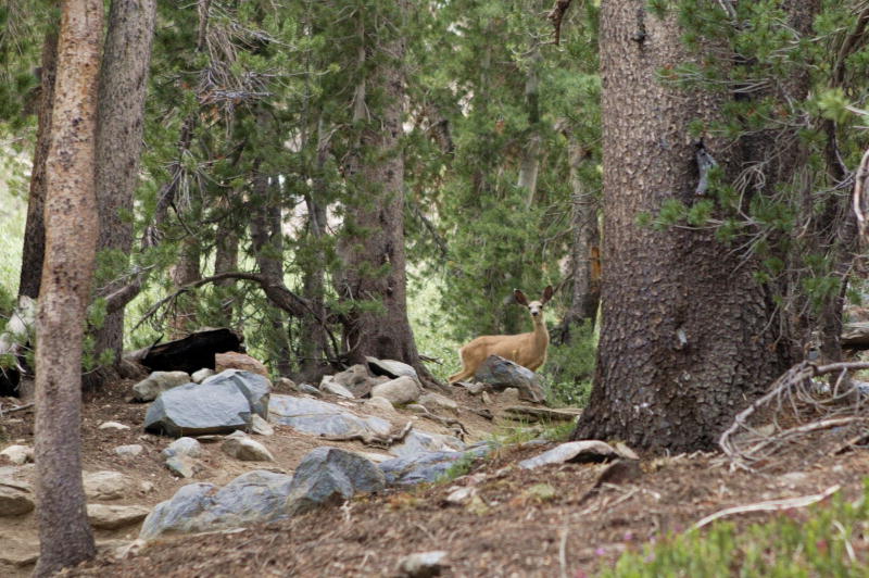
week or more. Wildlife were having their field day, with non-stop noisy bird calls and frequent
appearances of chipmunks scuttling around. After a long hike down we finally made it to the
trailhead, and now we needed another lift to cover the extra 1.3 miles it takes to reach our car.
We did find a young guy willing to take us, and fortunately didn't have to walk any more.
Although we didn't even get to the base of Mount Sill on this trip, at least we've learned
more about the conditions of its approach and how we fare under these conditions. In order to
make a successful trip to Mount Sill we will need to do much better with food and water planning,
logistical and camp site planning, as well as better acclimatization. Certainly more physical
training wouldn't hurt either, but the most important factors seemed to be preparation.
Bishop Pass Trail
Climbing Mount Agassiz
Trekking towards North Palisade and Mount Sill
